GeoServer使用CSS定义地图样式-插件安装
目录
Geoserver 插件都随主程序版本在更新,所以下载插件要选对应版本!
下载插件
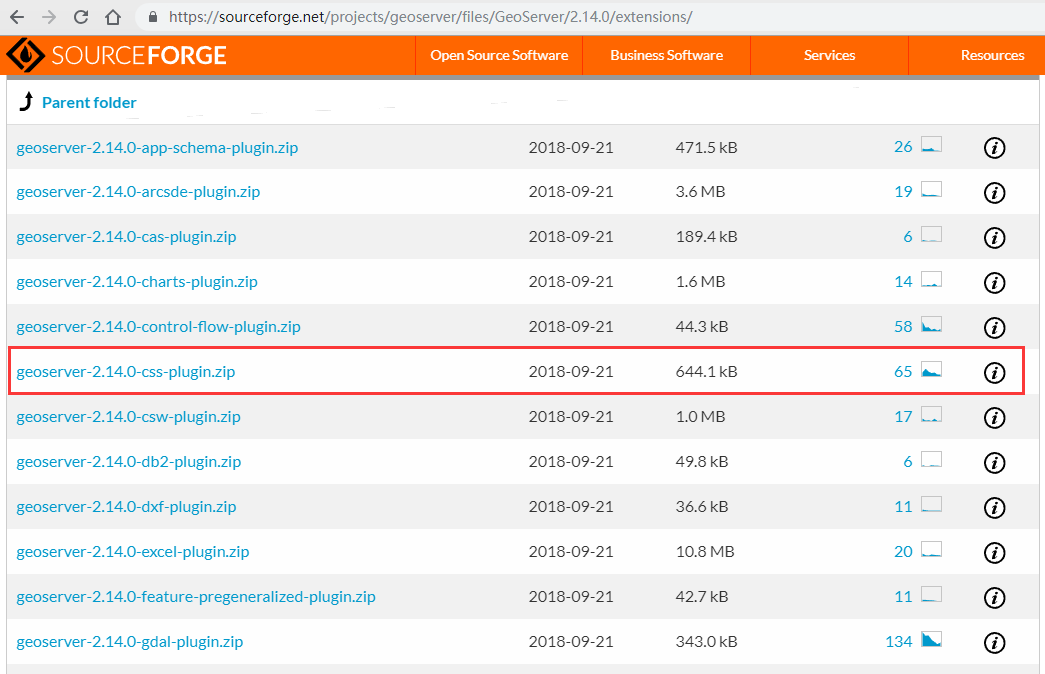
下载插件
查看插件内容
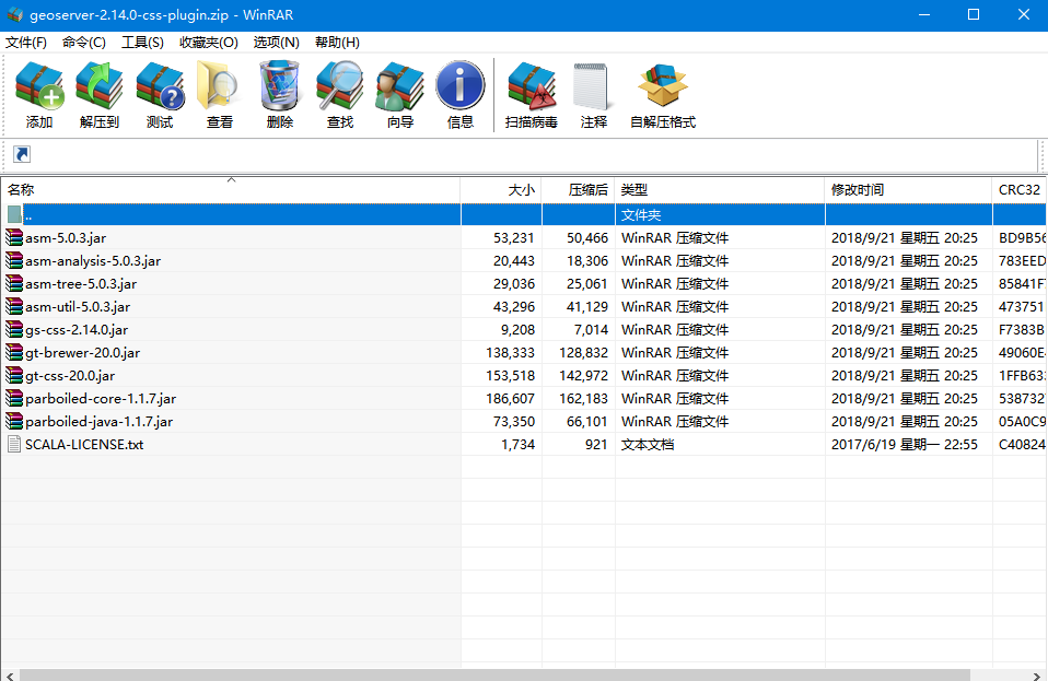
插件内容
拷贝插件到指定位置,重启geoserver
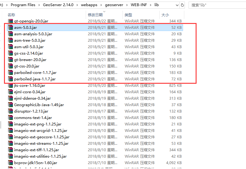
安装插件
使用插件新建样式
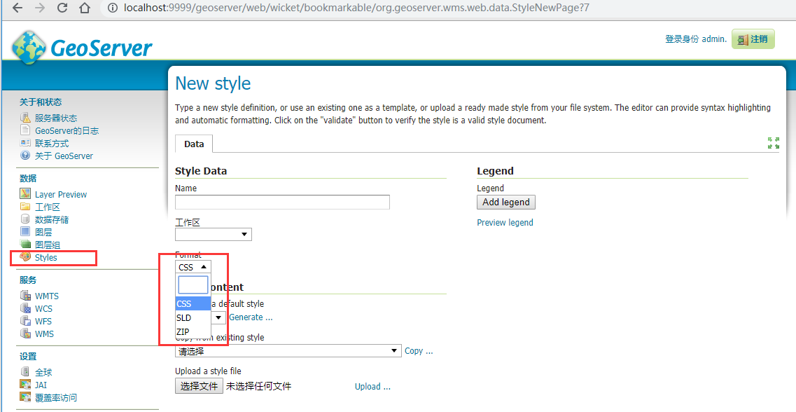
新建CSS Style
CSS Style效果预览
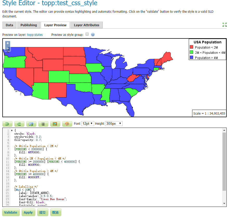
预览效果
Demo代码
* {
  stroke: black;
  stroke-width: 0.2;
  fill-opacity: 0.7;

  /* @title Population < 2M */
  [PERSONS < 2000000] {
    fill: #4DFF4D;
  };
  /* @title 2M < Population < 4M */
  [PERSONS >= 2000000] [PERSONS < 4000000] {
    fill: #FF4D4D;
  };
  /* @title Population > 4M */
  [PERSONS >= 4000000] {
    fill: #4D4DFF;
  };

  /* Labelling */
  [@sd < 20M] {
    label: [STATE_ABBR];
    label-anchor: 0.5 0.5;
    font-family: "Times New Roman";
    font-fill: black;
    font-style: normal;
    font-size: 14;
  }
}
转载自:https://blog.csdn.net/weixin_34018202/article/details/87218460