Counting down our best
Every year we countdown our best.
For 2021, here are our top articles that you’ve shared and liked the most.
Thank you GIS community for being so awesome.
All the best in 2022 – it can only get better from here.
Best of 2021
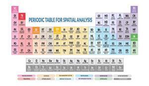
- The Periodic Table for Spatial Analysis
- 35 Differences Between ArcGIS Pro and QGIS 3
- Best Handheld GPS Receivers
- 5 Best Free LiDAR Software Tools and Applications
- Space-Time Cubes: Stack Time Like Lego
- The Living Atlas of the World by Esri
- 20 Non-Geospatial Tools for GIS Users
- What Are Story Maps? Story meet map.
- What is COGO (COordinate GeOmetry)?
- Google Earth vs Google Maps: What’s the Difference?
Best of 2020

- 10 Python Libraries for GIS and Mapping
- US Map Collection: The 50 States of United States of America
- GIS Editing Tools [Cheatsheet]
- What Exactly Is a GIS Specialist?
- World Atlas Map – Countries and Geography
- 5 Best Web Mapping Platforms – The Battle of Web GIS
- 10 GPS Apps For Navigation [Android and iOS]
- What is Photogrammetry?
- 3D Maps: A Complete Guide To See Earth in 3D
- Hyperspectral Imaging from Space
Best of 2019
- What is Geodata? A Guide to Geospatial Data
- 7 Free World Climate Data Sources
- 25 Satellite Maps To See Earth in New Ways
- 50 Map Projections Types: A Visual Reference Guide [BIG LIST]
- The Power of Spatial Analysis: Patterns in Geography
- 25 Map Types: Brilliant Ideas to Build Unbeatable Maps
- How to Learn GIS for Free
- 10 Topographic Maps From Around the World
- Free Historical Imagery Viewers to Leap Back in the Past
- What is Topography? The Definitive Guide
Best of 2018
- The Hidden Powers of QGIS 3: 33 Truly Underappreciated Features and Plugins
- 7 Geocoding and Reverse Geocoding Services for Pinpointing Addresses [Free and Paid]
- Esri JavaScript API Examples: 15 High-Tech Webmaps and Webscenes
- Mapping the Ocean Floor: Water Bathymetry Data
- The Rise of Machine Learning (ML): How to Use Artificial Intelligence in GIS
- 3 Active Fire Maps: How to Track Real-Time Wildfires Around the World
- OpenStreetMap Data: How to Download Crowd-Sourced OSM Data
- Sentinel Satellites of the Copernicus Programme
- MapInfo Professional by Precisely
- Anatomy of Autonomous Vehicles: Is GIS Really Under the Hood of Self-Driving Cars?
Best of 2017
- What Do Contour Lines on a Topographic Map Show? [1552]
- Geodesy: The Mathematics of “Where” [905]
- GPS Accuracy: HDOP, PDOP, GDOP, Multipath & the Atmosphere [813]
- Degrees/Minutes/Seconds (DMS) vs Decimal Degrees (DD) [804]
- How to Download USGS Topo Maps for Free [803]
- GIS Day is on November 15, 2017 [660]
- What is Tobler’s First Law of Geography? [626]
- Kriging Interpolation – The Prediction Is Strong in this One [611]
- Geosynchronous vs Geostationary Orbits [432]
- The Big Satellite List. 50 Satellites. 30 Words or Less. [197]
Best of 2016
- 1000 GIS Applications & Uses – How GIS Is Changing the World [6645]
- 15 Free Satellite Imagery Data Sources [4316]
- Free GIS Programming Tutorials: Learn How to Code [1769]
- Free Global DEM Data Sources – Digital Elevation Models [1462]
- What is a Geodatabase? Personal vs File Geodatabase [1395]
- DEM, DSM & DTM Differences – A Look at Elevation Models in GIS [1219]
- Agriculture Technology: How GIS Can Help You Win the Farm [707]
- How Universal Transverse Mercator (UTM) Works [563]
- Free Global Land Cover / Land Use Data Sets [526]
- Trilateration vs Triangulation – How GPS Receivers Work [518]
Best of 2015
- 27 Differences Between ArcGIS and QGIS – The Most Epic GIS Software Battle in GIS History [7119]
- How to Download Free Sentinel Satellite Data [2286]
- Mapping Out the GIS Software Landscape [1794]
- What is the Difference Between Geomatics and GIS? [1682]
- 13 Free GIS Software Options: Map the World in Open Source [1177]
- A Complete Guide to LiDAR: Light Detection and Ranging [918]
- Top 6 Free LiDAR Data Sources [896]
- The Remarkable History of GIS [815]
- 33 Map Elements to Include in Cartographic Design: A Guide to Map Making [787]
- GIS Dictionary – Geospatial Definition Glossary [764]
Best of 2014
- 10 Free GIS Data Sources: Best Global Raster and Vector Datasets [5463]
- 100 Earth Shattering Remote Sensing Applications & Uses [4295]
- 13 Open Source Remote Sensing Software Packages [1955]
- What is Geographic Information Systems (GIS)? [839]
- Image Classification Techniques in Remote Sensing [473]
- What is a Horizontal Datum Reference Frame? [203]
- USGS Earth Explorer: Download Free Landsat Imagery [188]
- ArcMap Tips and Tricks: The 7 Golden Rules [172]
- Multispectral vs Hyperspectral Imagery Explained [125]
- 3 Geology Maps that Explain the History of Earth [118]

